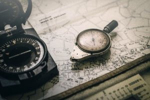
Long before satellites, people crossed oceans and coastlines using a compass, a chart, and a solid understanding of the Earth itself. This free online coastal navigation diploma from Alison teaches that time-tested craft. In roughly 10 to 15 hours at an advanced level, it covers the theory and practice of fixing and tracking a vessel's position using latitude, longitude, the magnetic compass, and chart plotting. It is the comprehensive, no-GPS navigation credential for anyone serious about finding their way on the water.
Why This Matters for Preppers
Real preparedness plans for the failure of the tools everyone leans on, and few tools are leaned on harder than GPS. This diploma builds the deep, traditional navigation knowledge that does not depend on any device. Understanding how position is found from the shape of the Earth and a magnetic compass is the ultimate backup for water travel, the skill that carried mariners safely for centuries before electronics existed.
The self-reliance angle could not be clearer. When you understand latitude and longitude, the behavior of the magnetic compass, and how to plot a position on a chart, you carry your navigation ability in your own head and hands. No battery, no signal, no subscription. For a prepper who values true independence, that kind of durable, self-contained skill is exactly the goal.
There is a strong value angle as well. Comprehensive marine navigation training is normally an expensive, formal course, and this diploma delivers it for free. For a boater, a coastal dweller, or anyone building serious water-travel skills, that is a substantial body of knowledge gained for the cost of time, and it can prevent the kind of navigational mistake that becomes a genuine emergency.
And this competence makes you an anchor for any group on the water. The navigator who can find the way when the electronics quit is the person everyone is glad to have aboard. In a prepared community, that traditional skill is a rare and reassuring thing to have on the team.
How Traditional Navigation Works
Traditional navigation rests on a simple, powerful idea: if you understand the shape of the Earth and can measure a few things accurately, you can always work out where you are. Latitude tells you how far north or south you are, longitude how far east or west, and together they pin any point on the planet. The magnetic compass gives you direction, and a chart lets you turn all of it into a plotted position and a course to steer.
This diploma builds that understanding from the foundations up. You study the Earth's dimensions, great and small circles, axial tilt, and how meridians and parallels create the grid we navigate by. Then you learn the practical craft: how the magnetic compass works and its quirks, how to establish position lines, and how to plot a course on a chart. It is the full journey from the theory of the globe to a pencil line on a chart.
What You Will Learn
This is a comprehensive, advanced navigation program. The main outcomes include:
- Understand the Earth: learn its radii, axial tilt, and great and small circles.
- Measure latitude: understand how north-south position is found.
- Work with meridians: grasp the significance of longitude and meridians.
- Know distance at sea: distinguish nautical and statute miles.
- Use the magnetic compass: understand how the compass works and how to trust it.
- Establish position lines: learn how position lines and fixes are formed.
- Plot on a chart: master the chart-plotting methods that put it together.
Together these skills give you a complete, device-free way to navigate coastal and open water. That deep traditional competence is one of the most self-reliant skills a water-going prepper can hold.
What the Course Covers
- The shape of the Earth: radii, circles, axial tilt, and the navigation grid.
- Latitude and longitude: measuring position north-south and east-west.
- Distance and direction: nautical miles and directional location.
- The magnetic compass: how it works and how to use it.
- Position lines: establishing lines and fixes.
- Chart plotting: turning measurements into a plotted position and course.
Where It Fits in Your Prep
This diploma is the backbone of a no-GPS water navigation skill set. Pair it with a good compass, paper charts, and simple plotting tools, and practice fixing and plotting positions on the water while your electronics still work, so the manual craft is second nature before you ever have to rely on it. Keeping these traditional tools aboard, and knowing how to use them, is preparedness in its purest form.
It builds naturally on the nautical charts course and leads into the celestial navigation courses on the Free Shelf, which extend your reach to positioning by the sun and stars far from land. Together, this trio covers near-shore, coastal, and open-water navigation without a single electronic device, which is a remarkable and genuinely resilient capability.
What This Course Is and Is Not
This is an advanced, maritime-focused diploma covering coastal and terrestrial navigation theory and practice. Despite the word terrestrial, its context is marine navigation, not backcountry hiking, so treat it as water-travel preparedness rather than land orienteering. It is thorough educational training, not a professional mariner's license, and it does not replace safe boating practice or local rules. It suits dedicated boaters and preppers who want deep, device-free navigation skill.
The lessons are free to finish. When you complete the course, a diploma is available that you can add to your resume or LinkedIn, and a credential like this can help you make the case for a job or a raise. Buying the diploma is optional and is never required to finish the lessons.
Final Thoughts
The ability to find your way with nothing but a compass, a chart, and an understanding of the Earth is one of the oldest and most reliable skills there is. This diploma teaches it in full, giving you a navigation ability that no outage can take away. For a prepared household with plans on the water, that depth of self-reliant skill is well worth the hours, and it is free to earn.
Start the free course and work toward your diploma.
Looking for more like this? Browse the Free Shelf, our growing shelf of free Alison courses for preppers.
Some links are affiliate links, and they never change your price. Details: /disclaimer